A Brief History of Getting Around in Vermont, Part 1
How the map got drawn: railroad tycoons, a turnpike era, and figuring out what highways are supposed to be for anyway.
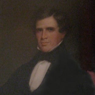
In 1843 the Vermont Central got its charter to build the state's first real mainline, and everybody understood roughly what that meant: a railroad connecting the Connecticut River valley to Burlington by way of Montpelier — the capital finally wired into the world. Charles Paine, ex-governor of Vermont and now president of the company, had a different map in his head. The line he actually built bent away from Montpelier and ran instead through Northfield, his hometown, hilly terrain and all, with the company's headquarters and shops planted there for good measure. The capital of the State of Vermont got a branch line.
Burlington fared no better. Rather than end his mainline in the state's biggest city, Paine ran it to a junction six miles east, a spot in the fields where he could capture the Montreal and Midwest traffic on his own terms. Burlington got a spur. People started calling the junction Painesville. Today it's Essex Junction, and if you've ever sat at the Five Corners wondering how the region's rail hub ended up there, the answer is: one man wanted it there, and it was his railroad.
That's the kind of story this piece is made of, so let me say plainly what this piece is: a factual history — dates, sources, the real record, corrected in a couple of places where popular history has it wrong — told by someone with opinions. After all, it's my newsletter.
Here's the territory: Vermont's transportation history from the railroad era through the highway era, told through infrastructure we still live with — the rail bed ghosting through Jericho, the number on VT-15, the toll road up Mount Mansfield, the one-lane top of Smugglers' Notch. This is Part 1 of two: the tycoons who drew the rail map, the two turnpike eras, the war over numbering the roads, and a lens for making sense of all of it. Part 2 is the interstate, the city that lost it, Vermont's half-built highways, and the road that finally opened after sixty-one years.
The railroad era: five men draw the map
For its first eighty years, Vermont's rail map wasn't planned. It was the accumulated personal geography of a handful of owners — where they lived, whom they hated, and what they wanted to block. Vermonters still live inside that map: the towns the rails fed became the towns that grew, and today's population distribution is mostly the rail era's doing.
Start with Paine, because his story has the whole era in it. The Vermont Central went bankrupt in 1853, wrecked by overexpansion; his stockholders forced him out, and he died in Texas scouting routes for the Southern Pacific. Northfield's yards emptied out when the reorganized company moved its operations to St. Albans. And none of this was an aberration or a scandal — it was the predictable output of the era's operating assumption, which held that private capital chasing private interest would add up, somehow, to a good transportation network. It doesn't. Investors optimize for their holdings, and the network inherits their portfolios: Essex Junction created, Northfield stranded, the capital and the largest city both sidelined — all of it working exactly as designed.
Every railroad war needs a losing side, and Vermont's was Timothy Follett, a Lake Champlain steamboat owner who built the rival Rutland & Burlington down the west side of the state — Bellows Falls to Rutland to Burlington, finished 1849. Paine's road refused to interchange with it, and it never got its own connection north to Canada, which in nineteenth-century railroading was a slow death sentence. Bankrupt by 1867, it was reorganized as the Rutland Railroad, a line rail historian Jim Shaughnessy described as connecting "nowhere to nowhere." The Paine–Follett feud hard-wired a two-corridor rivalry — central Vermont versus western Vermont — that echoes all the way down to the interstate fight a century later. That story is Part 2's.
The next generation consolidated. John Smith of St. Albans built the Vermont & Canada; when he died in 1858 his sons took over, and J. Gregory Smith — governor during the Civil War, later first president of the Northern Pacific — turned the Central Vermont into an empire, leasing the Rutland system and the Ogdensburg line to smother the competition. The Smiths ran Vermont railroading, and a good deal of Vermont politics, for two generations from St. Albans.
They also ran the board like a chess game, and one of their pawns matters enormously to anyone who drives in Chittenden County today. The Burlington & Lamoille Railroad was organized in 1877 to run from Burlington up to Cambridge Junction, with the towns along the line bonding themselves — mortgaging their own futures — to pay for it. It did real work: flour from the Old Red Mill, passengers into Burlington in about thirty minutes. But per railroad historian Jerry Fox, J. Gregory Smith created the B&L as a blocking move, a pawn to keep the Rutland out of his Central Vermont territory, never really meant to thrive. The towns mortgaged themselves for someone else's gambit. Reorganized in 1889 as the Burlington & Lamoille Valley, leased by the Central Vermont, dead by 1938.
Here's the thing, though: the corridors outlived the railroads. When the railroads died, their alignments were transcribed into the road network — ranked, roughly, in the order the rail war finished. The B&L is the cleanest case: VT-15 more or less follows the old alignment down the Lamoille and Winooski valleys, which means a line conceived — if Fox is right — as a throwaway blocking move ended up defining one of Chittenden County's busiest commuter corridors. Over 20,000 vehicles a day pass through its western end per 2022 VTrans counts, tapering to 4,000–10,000 between Jericho and Cambridge. Paine's winning Central Vermont spine did even better: a century of accumulated towns and traffic made its valleys the natural fit when the interstate criteria came reading the map. And Follett's losing western corridor still got its road — US-7 — but nothing like the same reliance. Even a minor decision, a railroad built as somebody's blocking move, can shape the geography for centuries. The roadbed itself still ghosts through Jericho, and the parallel StJ&LC corridor is now the Lamoille Valley Rail Trail; but the B&L's real monument is the traffic on VT-15 every weekday morning.
By the 1880s the tycoons weren't building empires anymore; they were accessorizing them. William Seward Webb married Lila Vanderbilt, got handed the Wagner Palace Car Company and eventually the presidency of the Rutland Railroad, and in 1886 assembled Shelburne Farms out of more than thirty lakeshore farms — Olmsted grounds, Robertson architecture. He commuted from New York in his private palace car, the Grand Isle, built by his own car company and hauled over his own railroad, and had Robertson design the 1890 Shelburne depot in the estate's matching Shingle style — the public station as an architectural extension of the compound. (His actually-private railroad-to-a-compound was next door in the Adirondacks: the Mohawk & Malone, running to his 200,000-acre NeHaSane preserve, mocked in the press as "Webb's Golden Chariot Route.") Station and palace car both sit at Shelburne Museum today, a short walk apart.
So the arc, in one line: Paine's generation bent public infrastructure toward private landholdings; Smith's generation played towns against each other as pieces on a board; Webb's generation rode the finished network to its estates. Then the Depression and the automobile called the whole game — the B&L dead in 1938, Rutland passenger service gone by 1953 — and the state ended up owning the corridors the tycoons had fought over.
What's left of all this, today: Amtrak's Ethan Allen Express reaches Burlington over the old Rutland tracks — state-owned since 1964, operated by Vermont Railway — while the Vermonter runs up the old Central Vermont spine through White River Junction. Freight still moves too. Wood chips roll to the McNeil plant at the Intervale, hauled by New England Central (the Central Vermont's successor) from the Swanton loading facility — at least 75% of McNeil's fuel arrives by rail, a floor written into the plant's permit. Vermont Railway runs fuel-oil unit trains into Burlington, Omya's limestone comes out of Florence, and a scatter of smaller operations rounds it out. Rail trails on the rest.
One coda before we leave the rails: why do the trains still run 1970s coaches? Both Vermont trains use Amfleet equipment dating to the Ford administration, and the binding limit on adding service is Amtrak's national rolling-stock shortage. The Airo replacement fleet is years behind schedule — the first trainset arrived in Seattle this past May for testing, with Cascades service expected this fall, the Northeast Regional waiting until 2027, and Vermont's routes somewhere down a list with no date attached — while record ridership pushes the old fleet to its limits. Behind that sits a strange piece of institutional design: when Congress created Amtrak in the Rail Passenger Service Act of 1970, it chartered a company that by statute "shall be operated and managed as a for-profit corporation" and "is not a department, agency, or instrumentality of the United States Government" (49 U.S.C. § 24301) — a business that has never once turned a profit in half a century, arguably was never expected to, and can't be allowed to die. And rail is sparse enough in this country that funding it reads in Congress as a favor to the few places that have it, while roads get funded without question, because everybody has roads. The ceiling on Vermont rail is set in Washington; this is the machine that sets it.
Over the mountains and gaps
Vermont has had two turnpike eras, and the second one wired an assumption into a century of highway building.
The first was quick and mostly forgotten. Starting around 1800 — the first charter went to a Middlebury–Woodstock route — the legislature chartered private turnpike companies by the dozen, with tollgates spaced at least eleven miles apart and toll schedules that read like a nursery rhyme: a penny for sheep, six cents for a horse, exemptions for churchgoers and trips to the gristmill. The average turnpike lasted about thirty years before the road went free and became the town's problem. The Winooski Turnpike, Burlington to Montpelier, is the local example with legs. And it's worth one line of echo here: Vermont's roads were private ventures before its railroads were. The rail tycoons were following a template, not inventing one.
The second turnpike era arrived with the automobile, and to understand the roads it built you have to recover how driving felt in 1910. Driving was a luxury good, and the experience was an astonishing upgrade on everything else available — no timetable, no rails, no station, no horse to feed, water, and rest; go where you want, when you want, at speed, on roads that were basically empty. Driving wasn't how you got somewhere. Driving was the thing.
The infrastructure this era built says so explicitly. Toll roads to mountain summits: the Mount Mansfield carriage road, completed to the summit in 1870, was rebuilt for automobiles in 1922 and reopened in 1923 as the Stowe Auto Toll Road — still operating a century later. Equinox Skyline Drive was completed in 1947 and opened in '47 or '48, depending which account you believe. Burke's toll road went up in 1935 on CCC labor. Resort hotels organized whole touring circuits: the Ideal Tour, promoted from about 1908 into the 1920s, ran hotel-to-hotel from Waterbury, Connecticut up through the White Mountains — the Equinox House in Manchester turns up all through the tour's 1920 guidebook as the Vermont overnight — and by the time of Mixer's 1925 map the circuit stretched from Atlantic City to Dixville Notch. Mountain crossings got improved in this era too, not for freight but for touring cars.
Smugglers' Notch is the perfect specimen. VT-108 was a smuggling route after the 1807 Embargo Act, an escape route for fugitive slaves, and then got improved for automobiles in 1922 — just in time for Prohibition liquor coming down from Canada, a nice bit of continuity in the road's original line of work. It's still one lane at the top with steep hairpins. In 1978 it was designated a State Scenic Road under the Vermont Scenic Roads Law — the first road in Vermont to get an official scenic designation, per the Lamoille County Planning Commission — which is the state formally certifying that this road's job is the experience of driving it. The modern comic relief writes itself: annual truck stuckages, chicane experiments.
The Appalachian Gap, VT-17, began as a turnpike. Three entrepreneurs cut a road through the gap in the 1930s, connecting Starksboro and Fayston, with a tollgate at either end and a dollar to pass — about $24 in today's money for the privilege of a rough mountain crossing. The state eventually bought the right-of-way for $7,500, put CCC labor into rebuilding it, got the highway over both sides by the mid-1950s, and didn't finish paving it until the 1970s. The road's official name is still the McCullough Turnpike. And the top — 2,375 feet, in Buels Gore, where the Long Trail crosses and Mad River Glen hangs off Stark Mountain just to the south — is now the summit finish for a stage of the Green Mountain Stage Race, whose riders earn it on sustained pitches of fifteen percent. One road runs the whole century: private tollgates, Depression labor, a state buyout, and a recreation economy at the summit.
New Hampshire deserves a couple of shout-outs here for the awesome mountain roads it built during this time:
- The Kancamagus began as an 1837 town road from Conway to Passaconaway; CCC labor built much of the Lincoln–Passaconaway stretch; it opened as a dirt road in 1959, was paved in 1964, and wasn't plowed year-round until 1968.
- Crawford Notch (US-302) is the older rail-and-carriage tourist corridor the Kanc was built to escape.
Now the part of this era that matters most, because it outlived the era. The definitive account is Robert Caro's: Robert Moses's Long Island parkways were designed for exactly this world — landscaped roads for pleasure driving, the road conceived as part of the park. That image of what a highway is, formed in the brief window when roads were empty and driving was joy, guided naive highway building around the world for decades afterward. Planners kept designing for a world of recreational motoring long after the car became mass transportation and the roads filled up. Vermont's toll roads and notch roads are charming fossils of that worldview. What the same worldview did when it arrived with federal money and a wrecking ball is Part 2's business.
Numbering the roads: boosters vs. system-builders
The same fight unfolded simultaneously all across the country in the 1910s and '20s, between people who wanted to build a great road — named, promoted, monumental — and people who wanted to build a road system — numbered, connected, boring, useful. VT-15 is a fossil of the moment the system-builders won, and this section is the story of how.
Before numbers, roads were marketing. Named auto trails promoted by private associations — the Lincoln Highway, the Dixie Highway, the Old Spanish Trail, plus scores of fly-by-night imitators — crisscrossed the country, marked by colored bands painted on telephone poles. New England's version ran through the auto clubs and state commissions from about 1915. It was the same phenomenon in California, the Midwest, and the South: enthusiastic, chaotic, and useless for navigation at scale, because the routes existed to promote the towns that paid dues, not to get anyone anywhere efficiently.
New England cleaned up first. In April 1922, the six state highway departments (plus New York east of the Hudson) replaced the colored bands with the New England road marking system — numbered interstate routes under 100, on yellow-and-black signs. Here's the Jericho fossil: NE Route 15, the "Burlington Bangor Way," ran from Winooski northeast along the Lamoille through Cambridge. VT-15 keeps the number today; most of the rest of NE-15, Danville to Houlton, Maine, became US-2. It was a regional dress rehearsal for what the country would do three years later — and note that the number was laid on a corridor the B&L had already validated.
The national version is substantially the work of one Bureau of Public Roads engineer, E.W. James, and the source for what follows is the man himself — a letter he wrote in 1967, at age ninety, now in the FHWA archive. It's a memoir, with a memoir's flattering light, and the sight of the old engineer still relitigating his win at ninety is half the charm.
- The vanity-project moment. In 1925 James was assigned to a "Committee of Two" with A.B. Fletcher of California, who unveiled his big idea: the longest single road in the world, numbered No. 1, Seattle to Key West — the greatest road in the world. James looked at the map, wondered where routes 2, 5, 10, 50, and 100 would go, concluded a map of such a system would be chaos, and — in his words — "I saw that I had better go it alone." One sentence containing the entire conflict of the era: Fletcher wanted a monument; James wanted a network.
- A system built to maximize trade. James's method for selecting routes wasn't aesthetic or political. He built county-by-county economic indices from census data — population plus agricultural, manufacturing, mineral, and forest output in dollars — mapped them as weighted emblems, and ran routes through the heaviest ones. When congressmen came complaining about their state's routes, the index maps were the answer, and — so James says — the pork-barrel pressure lost to the math. He even had an assistant compute the centroid of the whole selected system; it landed in the same Indiana county as the census center of the national population.
- The grid. Odd numbers north–south ascending westward, even numbers east–west descending southward, expansible indefinitely. James's own assessment was that the pattern was simple and stared you in the face.
- Killing the named trails. James knew the numbering meant the end of the trail associations — including the powerful ones — so he went to Detroit and told the Lincoln Highway Association to its face, trading them recognition in Route 30 for their support. With the strongest association on board, the rest folded. As for the US shield itself: by James's telling it was a doodle passed between him and Michigan's Frank Rogers at a Board meeting, though the shield's origin has competing accounts, so hold that one a little more loosely than the rest.
There's a deeper contrast hiding inside this story, and it's about governance inheritance. Vermont's road system rests on structures older than the country: towns that predate the state, town meeting as the engine of governance, and the road tax as a civic obligation — for generations a labor tax, farmers working off their assessment with a scraper and a team on the road past their own farm. Roads were something a community did for itself. The 1922 compact is pure New England in this light: six sovereign highway departments agreeing on signage while touching nothing about who owns or maintains the pavement underneath. California is the opposite inheritance — a state born in 1850 nearly fully formed, its counties drawn by convention as administrative conveniences rather than organic communities, no thick layer of ancient town prerogatives to negotiate with. So when the automobile arrived, California could simply act: one bond vote, one commission, one system covering an area the size of several New Englands. There's real value in that capacity — it's why California had a coherent state system under construction while New England was still harmonizing sign colors — and California has guarded it jealously ever since. Centralized capacity to build is as core to that state's identity as town meeting is to ours.
A practical note on what the signs mean now, because the numbering can mislead. The US shield on Route 2 and the state marker on VT-15 imply two systems; in funding terms they're one. US highways and state highways in Vermont are maintained by VTrans out of basically the same bucket of money — the state transportation fund plus federal aid — with the US number mostly a wayfinding legacy of the 1926 grid rather than a separate ledger. The signage that tells the real governance story is elsewhere: Vermont's green state shield marks state-maintained mileage, while the old black circle marker means a road is town-maintained but still cataloged in the state highway register — the town-meeting inheritance living on as an official sign class. (There are signing inconsistencies out there, which is its own very Vermont detail: the maintenance map and the sign map don't perfectly agree, and nobody's in a hurry.)
And nobody's-in-a-hurry deserves a postscript, because the 1922 instinct is still running, a century on. The 2009 federal MUTCD turned mileage-based exit numbering from "should" into "shall," and Vermont — a holdout alongside New Hampshire, Massachusetts, and Delaware — answered in 2020 by spending about $250K in federal money on roughly 70 small milepoint plaques mounted under the existing sequential exit signs on I-89, I-91, I-93, US-4, US-7, and VT-289. Officially the plaques improve crash and breakdown location reporting. Per the VTrans project lead, they also "allow us to postpone replacing our signs on a wholesale basis until the signs are at the end of their useful life" — which, with most signs 10–12 years into a 20–25-year lifespan and "no current plan or time frame" for full conversion, means the renumbering arrives when the big signs die of old age and not a day sooner. A century after the compact, the New England instinct is intact: agree about signage, concede nothing underneath, take your time.
Whose road is it? The balance problem
Having spent a section praising the system-builders, here's the turn: James's index maps answered where the trunk lines should go. They said nothing about what a road is for once it gets there. That's the actual dilemma in road planning — not who owns a given mile, but which traffic you plan around: the people going to the grocery store, or the people going through. What follows is a lens, not a thesis.
Plan around local access and you get a network where everything connects to everything nearby and nothing moves well between regions. Plan around express movement and you get corridors that serve the map and skip the places. Every road plan sits somewhere on that axis, and the position gets chosen whether or not anyone chooses it on purpose.
Over-represent either side and you get a signature failure. Too much local, and the network never forms: the state highway that becomes a village main street every eight miles, trucks grinding through downtowns, nothing moving well between regions. Too much express, and you get cavalier, half-finished building — right-of-way bought and abandoned, neighborhoods handed traffic they get nothing for, places off the corridor left behind. Vermont has managed both, and neither pole is the villain of this piece.
But there's an asymmetry between the two failures, and it decides the politics: only one of them is felt. The express-side failure has victims with addresses — a demolished block, a stub dumping traffic onto a neighborhood grid. The local-side failure's cost is inherently diffuse: it dissolves into the economy — freight costs, purchasing power, the nebulous objective of national defense — and never produces a scene. About the only way an ordinary person feels it directly is that road trips take a little longer than maybe they should — Chittenden County reaches New York City down state and US highways through the Lake George country, meeting the Thruway in the capital corridor — and driver convenience is the one argument this newsletter doesn't accept as valid. There's no equivalent on this side — the harm doesn't land visibly on any particular place or person — and that's why this failure is the durable one: nobody organizes against a cost they can't see themselves paying.
And then there's Rutland, which doesn't sit neatly on either pole. An oversized city in an out-of-the-way corner, it would plainly benefit from connection to the controlled-access highway system — and the centralized planning that drew Vermont's express network never delivered one. Centralization is probably the best model we have, but it isn't perfect; Rutland is the place in Vermont where it failed, and Rutland's unusual size makes it an urgent candidate for the connection it never got. The full story is Part 2's centerpiece; for now, just hold the shape of it.
That's Part 1, to recap: five tycoons drew the rail map out of their own portfolios, the recreation era built roads where the point was the road, and the boosters' painted names gave way to the system-builders' numbers. Two things in all of it are worth chewing on. The first is how much a place can be shaped by decisions that looked small when they were made — a railroad conceived as somebody's blocking move ended up defining a commuter corridor, and VT-15 has now carried a railroad, a route marker, and a workforce through the same valleys under three different flags. The second is the question sitting under the whole series: how do you balance the interests of the different people using a road — the ones going to the grocery store, and the ones going through? The early builders didn't know the dilemma existed, and a lot of what this series covers traces back to that blindness. Highway engineers have understood it for as long as there has been such a vocation; it just never reached the rest of us. That's the real tragedy here — these basic, boring principles of roadbuilding are civics, as fundamental as the three branches of government and the checks and balances between them, and awareness of them is poor.
The only thing that leaves is my cliffhanger. Twice now, the western corridor — Rutland's corridor — was in the room and lost: to Paine's interchange refusal in the rail war, and again when the corridors were transcribed into roads and the west side's US-7 got nothing like the central spine's reliance. Then, in 1956, the biggest checkbook in the history of roadbuilding arrived to redraw the stakes.
That story is coming up in Part 2.
Source Notes
- VTDigger, "Then Again" series on the Paine–Follett competition and the origins of Essex Junction; Vermont Central / Central Vermont histories (Northfield routing, 1853 bankruptcy, Smith dynasty and St. Albans)
- Jim Shaughnessy, The Rutland Road — the "nowhere to nowhere" line is quoted here as relayed by american-rails.com's Rutland Railroad history
- Jerry Fox (via the Underhill Historical Society) on the Burlington & Lamoille as J. Gregory Smith's blocking move; Old Red Mill history; VTrans 2022 traffic counts for VT-15
- Shelburne Farms National Historic Landmark documentation; Shelburne Railroad Station & Freight Shed (R.H. Robertson, 1890; moved to Shelburne Museum 1959); Shelburne Museum, Grand Isle palace car; Webb biographical material (Wagner Palace Car Co., Rutland RR presidency, Mohawk & Malone / NeHaSane)
- Rail Passenger Service Act of 1970; 49 U.S.C. § 24301 (Amtrak's statutory status); Amtrak and trade press on the Airo rollout — first Cascades trainset arrived Seattle May 2026, Cascades service expected fall 2026, Northeast Regional 2027, Vermont routes unscheduled (Amtrak Media, The Urbanist, Deep Arrival, as of August 2026)
- Vermont Historical Society, "Early Roads & Taverns" (turnpike charters from ~1800, toll schedules, thirty-year average lifespan)
- Almon C. Judd, The Ideal Tour (1920) — Equinox House / Manchester as the Vermont stop; Curtis Wright Maps listing for Mixer's 1925 "Automobile Map of New England Showing the Ideal Tour" (Atlantic City to Dixville Notch)
- Stowe Historical Society and WCAX (Oct. 2023) on the Mount Mansfield toll road centennial (1870 carriage road, 1922 rebuild, 1923 reopening); VT Forests, Parks & Recreation, Darling State Park (Burke toll road, CCC, 1935); Lamoille County Planning Commission (Smugglers' Notch State Scenic Road designation, 1978)
- McCullough Turnpike / Appalachian Gap: Happy Vermont podcast (Feb. 2023, with Johnathan Croft) and Sun Community News, "McCullough Turnpike: Vermont's long and winding road" (1930s private toll road with dollar toll, $7,500 state buyout, CCC construction, mid-1950s completion, 1970s paving); Green Mountain Stage Race route materials (App Gap summit finish)
- Robert Caro, The Power Broker (the parkway / pleasure-driving chapters)
- FHWA, E.W. James letter to F.W. Cron (1967) — the primary source for the Joint Board story, used as a memoir, not gospel; cahighways.org (Daniel Faigin) on US highway numbering history; coverage of the April 1922 New England road marking agreement; NE Route 15 "Burlington Bangor Way" route logs
- VTrans exit-numbering project materials; Valley News / VTDigger (July 7, 2020) on the milepoint plaques (~$250K, ~70 signs, and the "postpone" quote from the VTrans project lead); VTDigger (July 19, 2018) on state opposition to renumbering